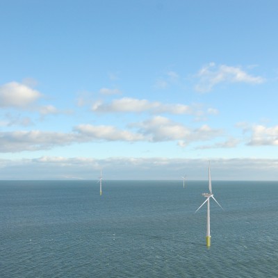
Moray East Offshore Wind Farm
Moray East was the first part of the Moray Firth Offshore Wind Farm Zone to be developed, and the first of the Round 3 projects to apply for (2012) and receive (2014) consent. The project is located in the Outer Moray Firth, approximately 22km to the east of the Caithness coast.
Part of the consenting process included an Environmental impact Assessment (EIA), which involved extensive consultation with the individual, organisations and communities. As part of the EIA, OPEN prepared the Seascape, Landscape and Visual Impact Assessment (SLVIA) for the offshore wind farm, as well as the LVIA for the onshore infrastructure (substation and cable route). OPEN prepared the written assessments, visual representations and geographic information to assist with the assessment and interpretation of landscape and visual effects. OPEN’s coastal characterisation of the Moray Firth was subsequently used by SNH as a best practice example in its coastal character assessment guidance.
Post-consent, OPEN prepared the design statement for the offshore wind farm providing information on the visual aspects of the design evolution of the final Moray East wind farm layout, as required by the Conditions of the Section 36 Consent.
After planning permission in principle was granted in 2015 for the onshore transmission infrastructure, OPEN prepared the substation landscape and appearance plans to meet the requirements of consent conditions. The landscape proposals for the substation site were designed to provide visual screening and respond to the rural character of the area with new woodland and hedgerow planting and grassland habitats.
OPEN also prepared the onshore cable route landscape plan relating to the landscape proposals and maintenance of the cable route corridor, providing details of existing and proposed landscape features to be retained and proposed throughout the cable route, including replacement native planting.
In 2017 Moray East won a 950MW contract for difference and is being delivered early in the 2020’s, with onshore and offshore infrastructure construction works currently in progress.

© Crown copyright and database rights 2018. Ordnance Survey 0100031673.
Contains OS data © Crown copyright and database right (2018).
Source: Esri, DigitalGlobe, GeoEye, Earthstar Geographics, CNES/Airbus DS, USDA, USGS, AeroGRID, IGN, and the GIS User Community


